Make tee signs and a caddie book for your course

Draw holes and caddie books right on a satellite map, so you get the real distances the first time. Export your caddie book, tee signs and course overview easily, as PDF and for print.

Try the designer

No account needed to try it.

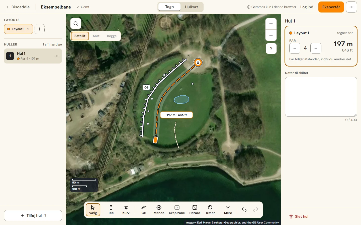
The Discaddie Course Designer on a satellite map: one hole drawn with tee, basket, a bent flight line, an out-of-bounds line and a pond. 197 m, par 4.
  • Real distances. Every line is measured on the satellite map, in meters or feet. Bend it to follow the fairway and the length follows.
  • Tee signs with the hole map. Each hole gets a sign with the map, par, distance, OB, mando and drop zones. If the course has several layouts, each gets its own color.
  • A caddie book for the whole course. Every hole in one PDF, in A5 or A4. Print it and hand it out, or keep it in your bag.
  • No design software. It runs in your browser, and your work is saved as you draw. Water and paths from OpenStreetMap can go on the hole maps.
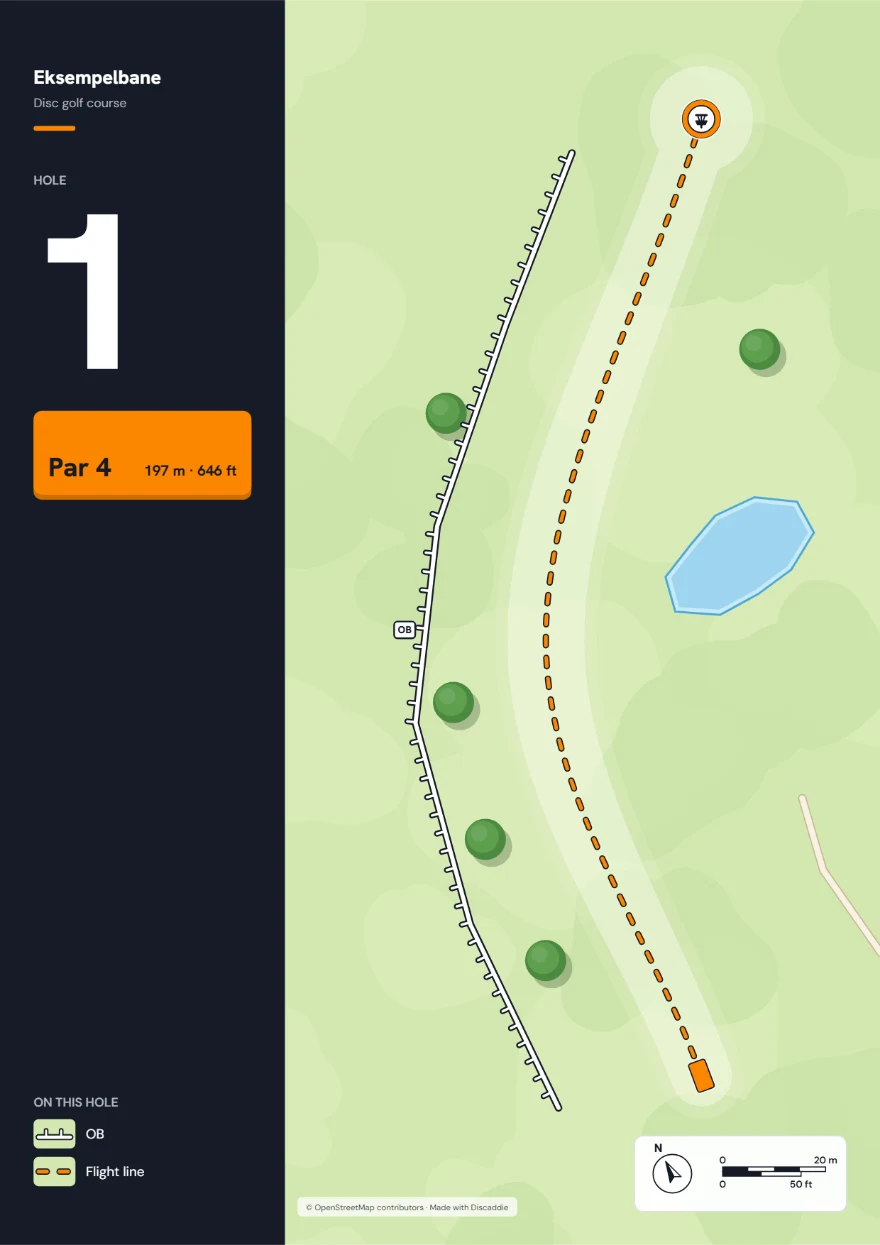
A tee sign exported from the Course Designer as a PNG: hole 1, par 4, 197 m, with the hole map showing the flight line, an out-of-bounds line, trees, a pond and a path.

Example: Bolbro, Denmark, front 9

Made in the Course Designer.
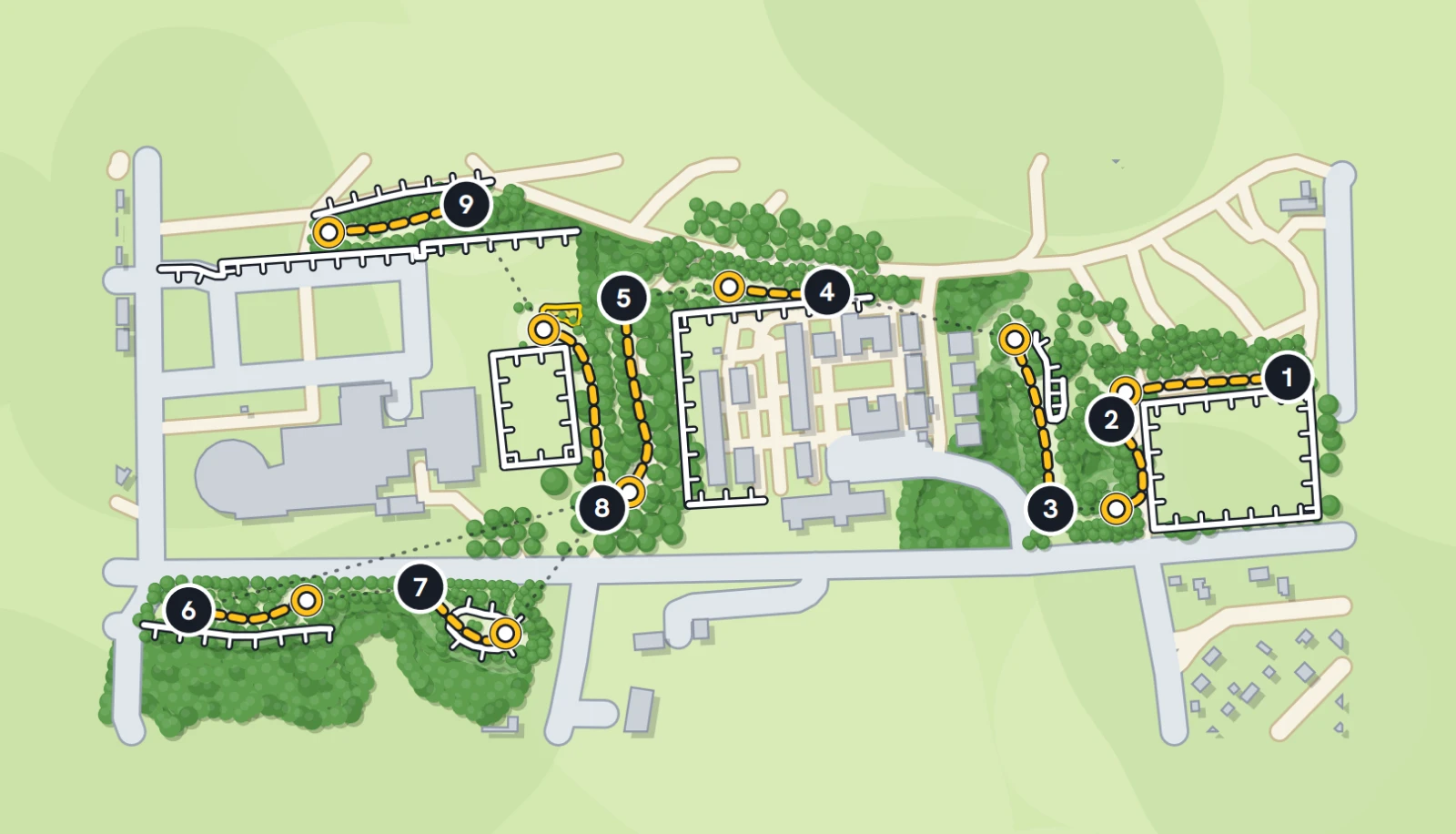
Overview map of the front 9 at Bolbro, Denmark: nine holes numbered 1 to 9 with yellow flight lines, trees, paths and OB areas.
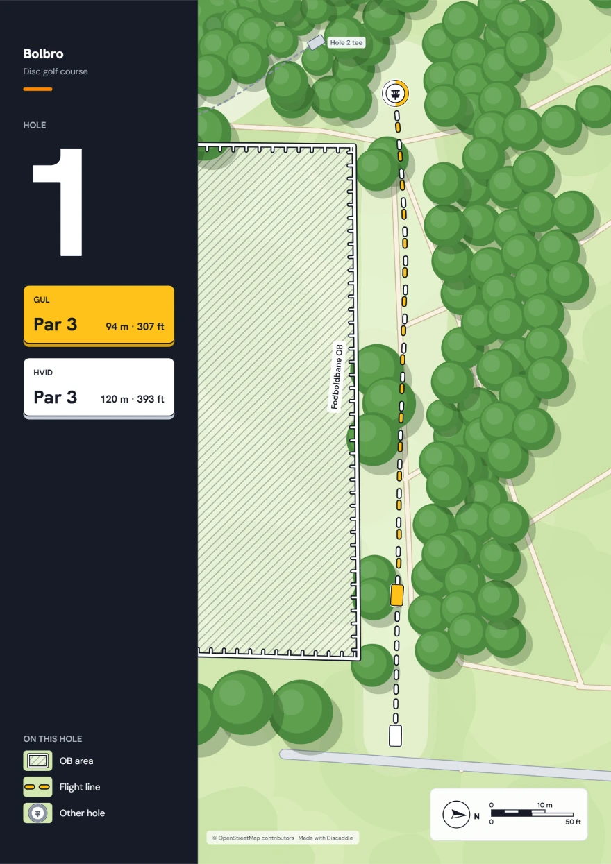
Tee sign for hole 1 at Bolbro: par 3, 94 m yellow and 120 m white, OB area on the left.
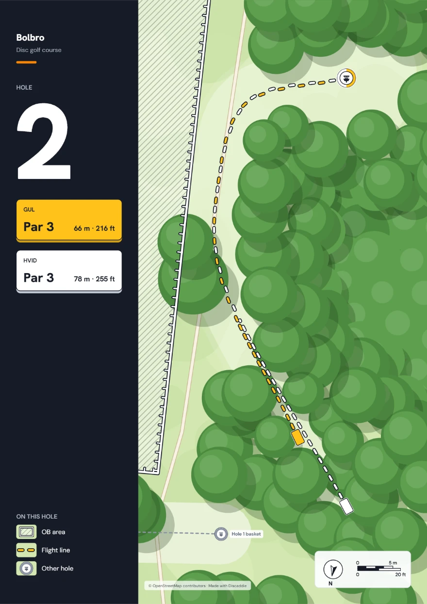
Tee sign for hole 2 at Bolbro: par 3, 66 m yellow and 78 m white, OB area on the left.
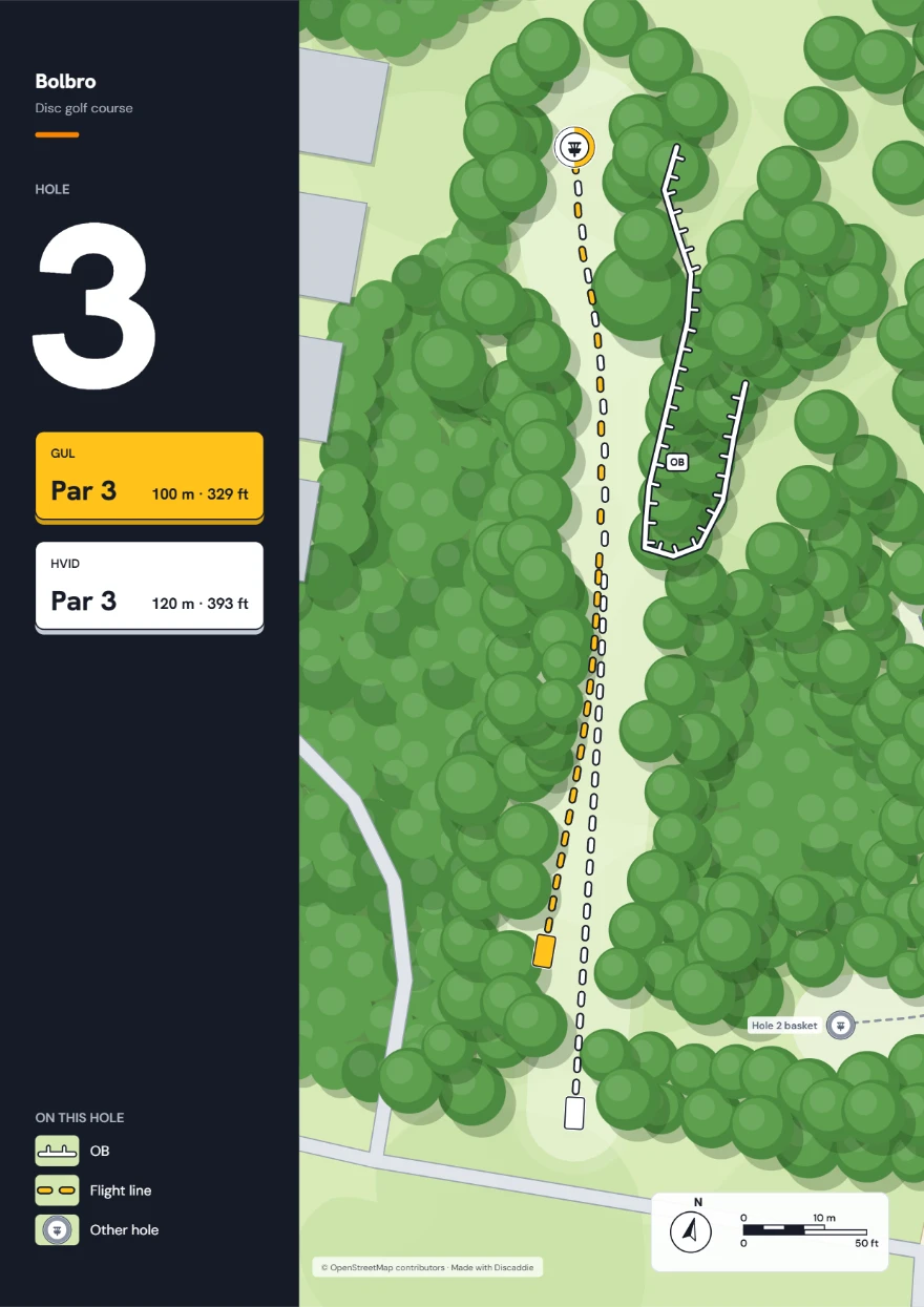
Tee sign for hole 3 at Bolbro: par 3, 100 m yellow and 120 m white, OB on the right.
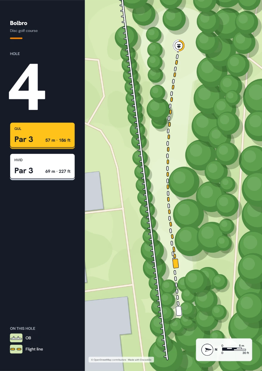
Tee sign for hole 4 at Bolbro: par 3, 57 m yellow and 69 m white, OB on the left.
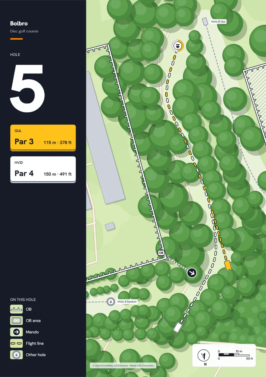
Tee sign for hole 5 at Bolbro: par 3 at 115 m from yellow and par 4 at 150 m from white, OB, an OB area and a mando.
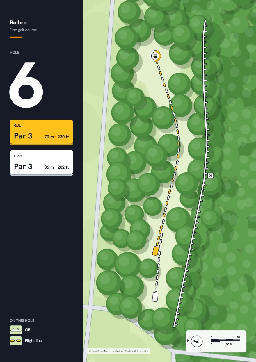
Tee sign for hole 6 at Bolbro: par 3, 70 m yellow and 86 m white, OB on the right.
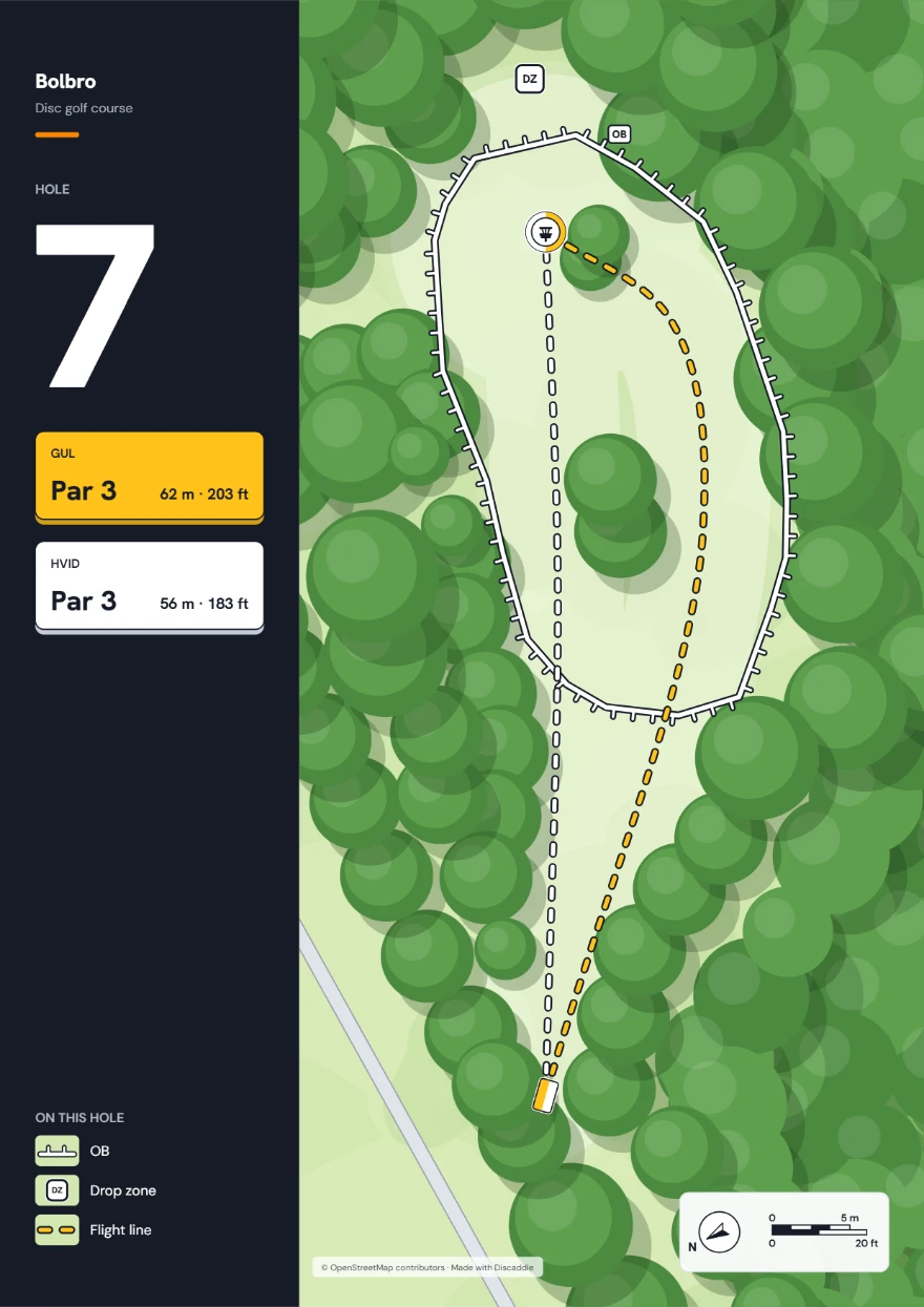
Tee sign for hole 7 at Bolbro: par 3, 62 m yellow and 56 m white, an OB area around the basket and a drop zone.
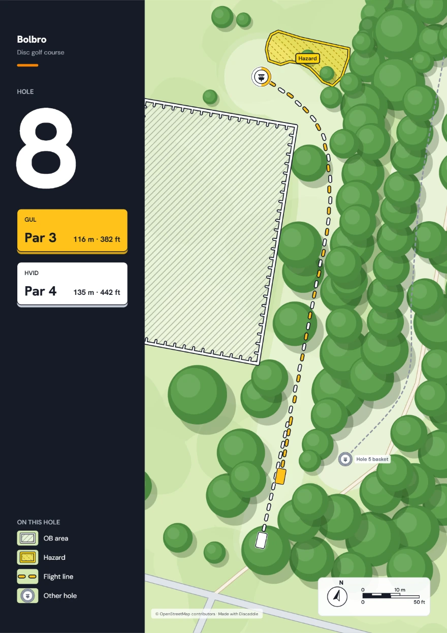
Tee sign for hole 8 at Bolbro: par 3 at 116 m from yellow and par 4 at 135 m from white, an OB area on the left and a hazard.
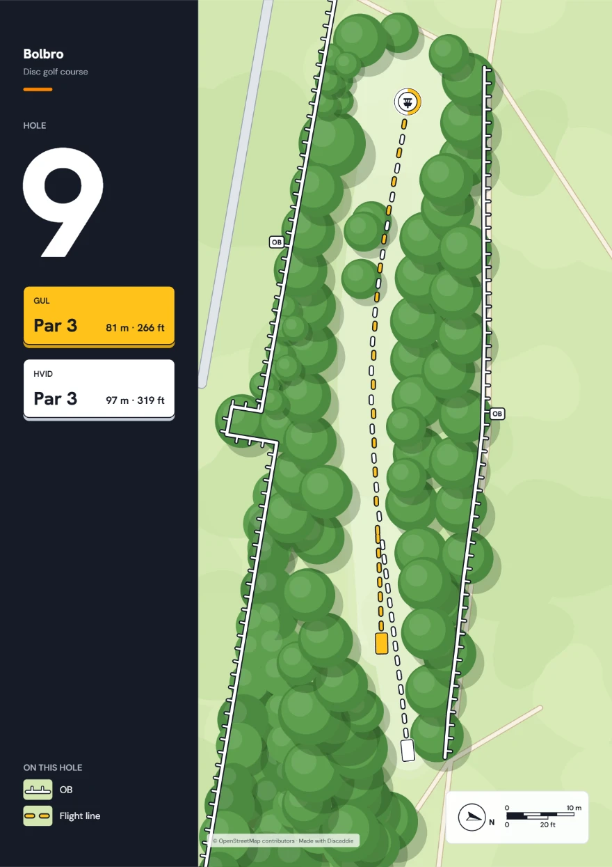
Tee sign for hole 9 at Bolbro: par 3, 81 m yellow and 97 m white, OB on both sides.

How it works

  1. Find your course.Search for the park. The satellite map loads.
  2. Draw the holes.Click the tee and the basket. Bend the flight line to follow the fairway. Add OB, mando, drop zones, hazards, trees, paths and water.
  3. Export.Choose tee signs, course overview or caddie book. Download as PDF, or as PNG for a single sign.

FAQ

Do I need an account?

No. The designer opens without a login. You need an account to save your courses to it and to get map data (forest, water and paths). Discaddie is in beta, and an account needs an invite code. Sign up for the list at discaddie.com to get one in one of the next waves.

Is my course saved?

Yes, in your browser, as you draw. If you clear your browser data or switch computers, it is gone, so save a project file as a copy. Log in and you can save your courses to your account and open them on other computers.

What can I export?

Tee signs and a course overview as PDF, single signs as PNG, and the whole course as a caddie book in A5 or A4. Signs come in A4 or Letter.

Does it cost anything?

Trying the designer costs nothing. Saving to an account is part of the beta, and the terms can change afterwards.

Tee signs and a caddie book for your course

Draw the holes on a satellite map with real distances, and print the result.

Try the designer

No account needed to try it.